By Keith J. Hamel, WPAOG staff
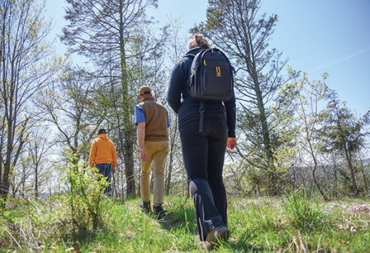
Whether you loathed land nav as a cadet or you couldn’t wait to participate in the next Norwegian Foot March (or “Marsjmerket”), there is a hiking trail that’s perfect for you not far from the gates of West Point. The mid- to lower-Hudson Valley is one of New York state’s premier hiking areas, with dozens and dozens of trails of varying distances, elevations, and terrain all within a 7.5-mile radius of your Rockbound Highland Home. Five of the “10 Best Hiking Trails in NY,” according to BestThingsinNY.com, can be found in this radius; similarly, four of the top eight “Best Trails in NY” as rated by AllTrails.com (an app for outdoor activities with a global user base of more than 20 million) are close by. If you’re looking for something to do to fill some downtime during a visit to West Point, read about the trails on the following page and take a hike!
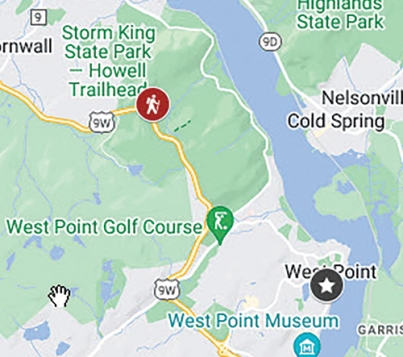
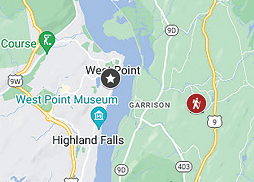
Check out WPAOG’s interactive map to help you navigate to these great hiking spots! If you take one of these hikes during a visit to West Point, tag us in your photos on social media.
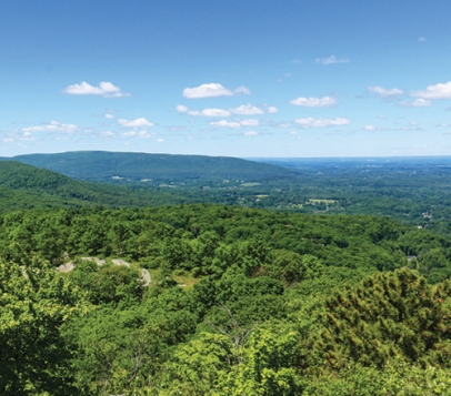
Storm King State Park
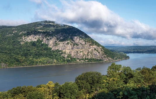
What: Storm King State Park is a network of trails, from short distance out-and-back trails to the 7.7-mile North Point Storm King Mountain Loop.
Where: Approximately 4 miles north on U.S. Route 9W from West Point’s Stony Lonesome Gate, you’ll find a pull off from the highway that leads directly to a parking lot for six Storm King State Park trails.
Why: The views! There are multiple ledges on the trails that provide 360-degree views of the Hudson Valley (with the Catskill Mountains visible on clear days).
Watch Out: Some trails have strenuous scramble sections, and there is a narrow ridge walk along the North Point Loop trail. Also, some have reported that the various trail markers don’t always make it clear where to turn, putting hikers on a trail different than the one they started on.
West Point “Rating”: The 1-mile Butter Hill via Orange and Yellow Trail could be considered the equivalent of the lunch formation march to the cadet mess; the 3.6-mile Storm King Mountain Loop, with an elevation gain of 1,102 feet, may be akin to morning PT; and the 6.7-mile Butter Hill and North Point Summit trail (2,178 feet of elevation gain) likely ranks as strenuous as the IOCT (and, like the IOCT, it ends at a different place than where you started).
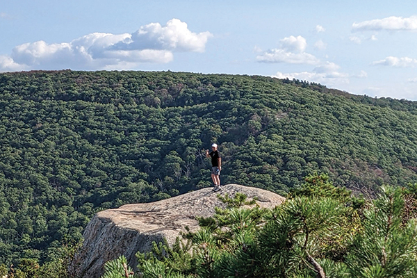
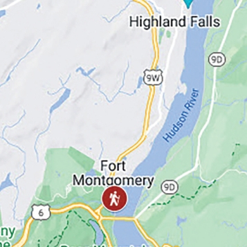
Popolopen Torne Loop—“Trail of the Fallen”
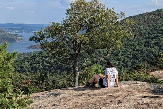
What: This is roughly a 5-mile loop trail that takes hikers to the top of the Popolopen Torne, a small mountain with a “bald-top” summit of 942 feet. Going clockwise along the loop, the trail meets up with the Trail of the Fallen, or Timp-Torne Trail (which, for those seeking a shorter [1.2-mile] hike, can be directly accessed via a parking lot on Mine Road).
Where: Approximately 4 miles from Thayer Gate, south on 9W. Take a left into the Fort Montgomery State Historic Site (there is free, overflow parking slightly north of this site, also on the left-hand side). If you enter the Bear Mountain Bridge traffic circle, you’ve gone too far. No problem, simply go around the circle and head north on 9W; the turn off will now be three-tenths of a mile on your right (or a little more than a half mile for the overflow parking lot).
Why: At the summit is a large mound of painted rocks, which have been carried up the trail to form a memorial to soldiers who have died in military conflicts. Flags, headstones and two benches (one for Major Thomas “TK” Kennedy ’00 and another for First Lieutenant Daren Hidalgo ’09) are also part of the memorial, which was dedicated in 2014. The summit offers stunning views of the Bear Mountain Bridge and the Hudson River, and you can also spy West Point in the distance.

Watch Out: The Trail of the Fallen is a leg-burner, elevating 500 feet in less than half a mile. There are thick, 20- to 25-feet-long climbing ropes with “knot handles” to assist those who need help climbing the very steep rock faces. As for the Popolopen Torne Loop, some have reported that the trail can be slippery in spots, rocky as it ascends from the lower valley, and marred by traffic noise from U.S. Route 6.
West Point “Factor”: As a team-building exercise, several Army West Point teams and groups have carried rocks up the Trail of the Fallen and added them to the memorial, and the trail and summit monument received significant upgrades (kiosk, trail markings, memorial benches, and trail re-naming) from Second Lieutenant Grant Nawoichyk ’23, who did the work as part of his Eagle Scout project in 2013.
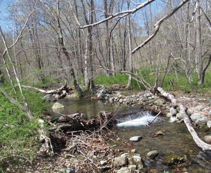
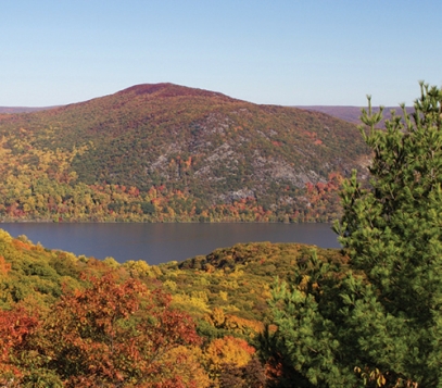
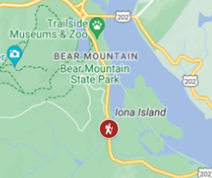
Bear Mountain State Park—Doodletown
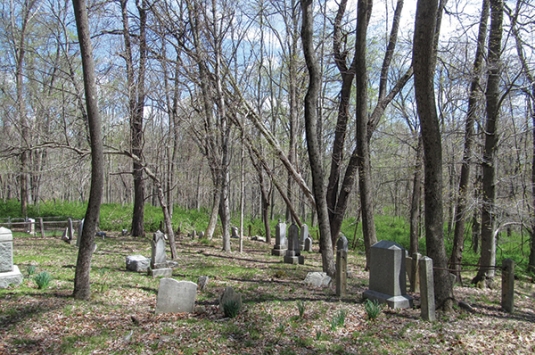
What: Bear Mountain State Park is comprised of 5,205 acres. It offers more than 50 trails, including a portion of the Appalachian Trail. Part of this trail network takes hikers to Doodletown, the remnants of a small, isolated community that lasted for approximately 200 years before it was abandoned in the mid-1960s, leaving what now has the atmosphere of a ghost town.
Where: Approximately 5 miles from Thayer Gate, south on 9W and staying south on U.S. Route 202 after the Bear Mountain Bridge traffic circle, you will find several trailheads on your right. For a guaranteed parking spot (with a fee), take Seven Lakes Drive to Bear Mountain State Park and use the 1777 East trail next to the carousel. For a weekday or off-season hike, continue south on 202 for about a mile and park along the opposite side of the road (if you pass the Iona Island Access Road, you’ve gone too far) and take the Cornell Mine Trail (Doodletown Road) until it meets up with the 1777 East trail.
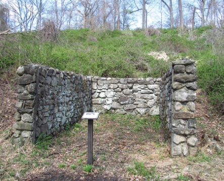
Why: Visiting Doodletown is like going back in time. Highlights include two cemeteries, more than 30 informative signs, and fragments of foundations, walls, and staircases.
Watch Out: While rated an “easy” hike, there are several hundred feet of elevation gain on this out-and-back trail. At one point, the 1777 East trail comes to a fork for 1777 West and 1777; be sure you know which one you started on in order to get back. Portions of the trail and the “yards” of Doodletown can become quite overgrown; watch out for snakes! (Rattlesnakes, copperheads, black snakes and garters have been sighted.)
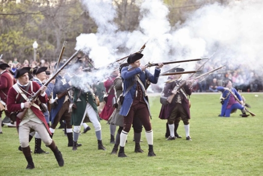
West Point “Connection”: A historical marker along 9W notes, Doodletown is a “pioneer Hamlet through which the British army marched to attack Ft. Clinton, 1777.” The attack destroyed all American defensive efforts, forcing American Patriot troops to start construction on major defensive works at a new site in January 1778—West Point. In February 1778, soldiers from the 3rd Connecticut Infantry Regiment began to lay out a fort at West Point, which also eventually became known as “Fort Clinton.”
Fort Hill—South Redoubt
What: South Redoubt was part of the final expansion of the West Point defensive fortification system. These fortifications (redoubts 1, 2, 3, North and South) were built during the late spring and early summer of 1779 to control the high ground surrounding West Point on both sides of the river. During use, its three batteries (comprised of one 12-pound cannon and four 6-pound guns) were manned by 160 soldiers.
Where: While it’s only 1.7 miles east of West Point as the crow flies, accessing this hike requires heading south on 9W, crossing the Bear Mountain Bridge, and heading north on New York State Route 9D (approximately 11 miles). After passing Garrison Elementary School and St. Philip’s Episcopal Church in the Highlands, take a right on Snake Hill Road. Just three-tenths of a mile up the road on the right is the trailhead for North Redoubt (Red) trail. This will take you to South Redoubt trail, or you can save yourself some toil by going further up Snake Hill Road until you reach a dirt-road on your right (a bit before the Garrison Golf Course) that’ll take you past a house to the South Redoubt trailhead.
Why: Those who hike to South Redoubt are treated to the next best view of the Academy outside of an aerial shot. All academic buildings, barracks, and the Cadet Chapel are clearly visible. In addition, you get to see the “S”-shaped curve in the Hudson River and understand why General George Washington believed in the strategic importance of West Point in the war against the British.
Watch Out: Some hikers have complained that the trail gets overgrown in the summer. Also, it is not usual to be the only hiker on this trail. If solitude and the stillness of the woods is unsettling to you, hike this one with a partner.

West Point “Re/View”: In addition to seeing West Point across the Hudson River, there is a significant “West Point” historic component to this hike. According to “22 Hikes in Philipstown,” a 2005 publication by the Philipstown Greenway Committee, “On September 25, 1780, George Washington was inspecting the South Redoubt at the very moment that Benedict Arnold was fleeing to the river from the West Point commandant’s headquarters just off Route 9D (which is visible to the south from the South Redoubt).”